|
Water Erosion Add-On (WE)
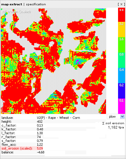
In the course of Climate Change, extreme weather events will increasingly influence land uses. For example, it is to be expected that the frequency of heavy rain events will increase in the next decades and hence, the water erosion on affected fields. The WE calculates and visualizes the amount of soil loss regarding various land use- and crop rotation- simulations. Soil loss is calculated with the help of the Universal Soil Loss Equation (USLE). It considers the intensity of precipitation (climatic factors), soil properties (pedogenic factors), relief properties that are relevant for water runoff, like length and inclination of slopes (topographic factors), as well as kind of land cover type and land management system (land use specific factors). The mentioned information finds entrance into the six parameters, which are of interest in the USLE and which result in the soil loss in tons per hectare and year by multiplication. The Figure shows a screenshot of the WE.

By starting the WE in GISCAME, the “map extract”, which by standard feature shows the elevation map, is illustrated. By clicking into the cells, besides elevation all other factors of the USLE, soil erosion, and mass balance are mapped. The illustrated factor is marked in red. The map can be changed by clicking on the list of factors below the map. A drop down menu offers the management typed (ploughing, mulch seeding and direct seeding), which influences the c-factors of the land use types. In the menu item “specification”, the crop rotation type-specific c-factors are defined.
Furthermore, the WE considers linear landscape elements, such as hedge rows, ruderal stripes or tree lines. These elements can cut the slope length and therefore cut the surface runoff, which consequently reduced soil erosion behind such linear elements. The simulation of linear landscape elements at fields and their effects on soil loss is being applied in the field of spatial planning, agricultural and nature protection authorities, and framers. Results of the WE are used as argumentation support for habitat network planning and re-structuring plans of agricultural landscapes.
|